Product Categories » AgLeader » InCommand 800
InCommand 800

The  display serves as an economical hub for your precision farming operations. Take advantage of our most popular year-round precision tools all in one package: machine guidance control, SeedCommand™ planting control, DirectCommand™ application control, yield monitoring and more.
More precision in the fields means more money in the bank!
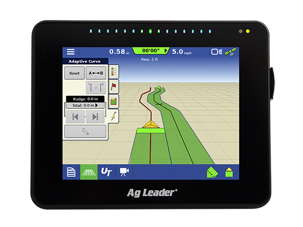
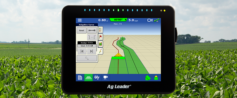
Versatile Precision Ag Display
Powerful tools, affordable price
Our sleekest, most flexible display ever. Loaded with new looks and interaction all with the same user-friendly functionality you've come to expect from Ag Leader.

Highlights:
- Tablet-like interaction
- Swipe, pinch, pan and zoom gesture support
- Touch and go homescreen apps
- Integrated lightbar
- Year-round functionality
- ISOBUS/Universal Terminal/Task Controller
- WiFi adapter included
- Syncs data, maps with iPad using AgFiniti® Mobile
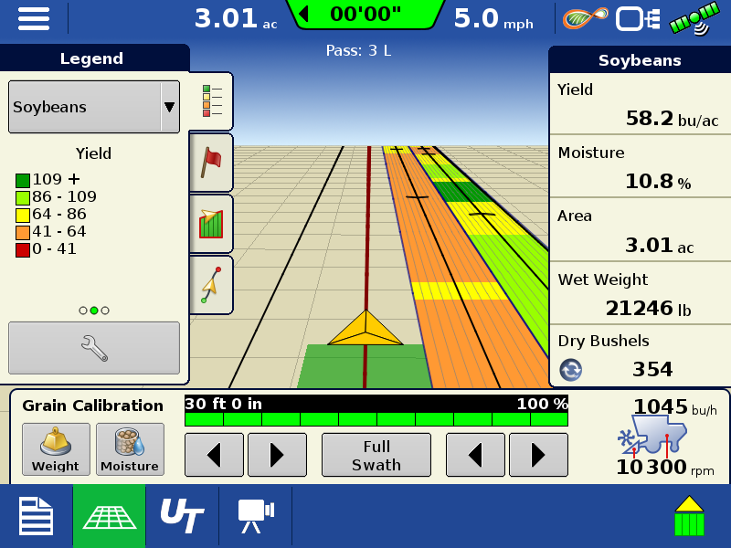
Maps in the cab
Powerful mapping capabilities
Tablet like interaction with maps including pan, pinch, swipe gestures .
Mark field borders, sub-boundaries, in-field obstacles, waterways or tile lines in real time from your cab.
Maps on the go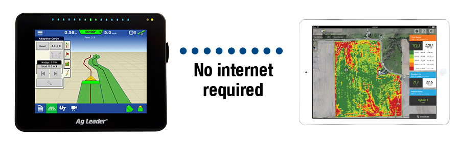
Take your maps with you!
In the cab or on the go, data collected from your InCommand 800 display is readily available on your iPad® with AgFiniti Mobile, no internet connection or USBs required.
Why InCommand 800?
Features and Benefits
Tablet-like Interface - Pinch, pan, zoom and swipe gesture support. Bright, new homescreen menu with field operation buttons.
Year-round Precision - Control and record field data year-round, including planting with SeedCommand, application with DirectCommand and yield monitoring.
Automated Steering - Simple setup and seamless integration with SteerCommand™ with GPS 6500 or OnTrac3™ steering systems makes controlling from the cab easy.
AutoSwath™ - Automatically turns planter or applicator sections on/off based on field maps.
Automatically turns planter or applicator sections on/off based on field maps - View real-time field data in a chart or map form.
Variable Rate Control - Eliminate wasted seed, fertilizer and chemicals using variable rates from planting or application prescription maps.
Headlands - Define a Headland as an offset from a boundary. It can then be used as a visual reference and to perform AutoSwath™ control.
